Search Term Record
Metadata
Name |
Saranap |
Related Records
-
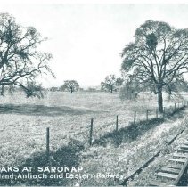
2017.54.6 - Photograph of the Oaks at Saranap. Line of Oakland, Antioch, Eastern Railway. Year unknown.
Record Type: Photo
-
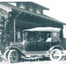
2017.54.7 - Photograph of automobile in front of home. Possibly Dewing Ranch, Saranap? Year unknown.
Record Type: Photo
-
-
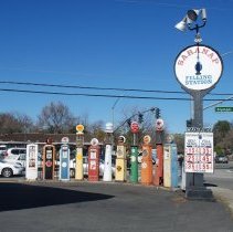
2018.45.1 - Photograph of the Saranap gas station located at the south west corner of Olympic Blvd and Tice Valley Rd in the 1880-90s and 1/2 of the 2000s Previously there were a few at the old original gas station but it was sold in the 2000s and the pumps removed.
Saranap gas station gas pumps
Record Type: Photo
-
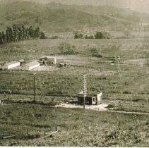
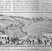
P157 - Picture (sketch) of vineyard and farm of Joseph Naphtaly SARANAP AREA Narrative and picture showing vineyard and farm of Joseph Naphtaly near Walnut Creek - year unknown.
Saranap Naphtaly
Record Type: Photo
-
P5014 - Photo of Highway 24 - 4 lane w/divider strip c. 1950 - Old Tunnel Road in foreground. Mt. Diablo in background. PRIOR TO 24 FREEWAY. ROAD PART WAY UP THE HILL IS CAMINO DIABLO. TAKEN FROOM A SARANAP HILL
Mt. Diablo landscapes Old Tunnel Road Highway 24 Saranap 1950's
Record Type: Photo
-
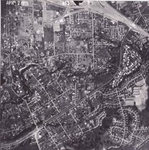
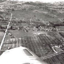
P6380T - Aerial photograph dated April 7, 1959. Shows Saranap area. Parkmead Elementary School center right, freeway construction.
Parkmead Elementary Hwy. 680 State Hwy 24 Saranap aerial 1959
Record Type: Photo
-
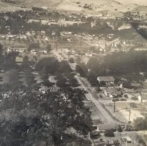
P6383A - South Walnut Creek looking west toward Saranap. Street names/placement on second photo. Lancaster Rd. Castle Hill Rd. Main St.
Lancaster Rd. Castle Hill Rd. Main St. Saranap aerial 1950's
Record Type: Photo
-
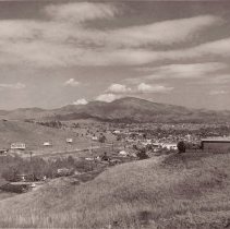
P6388 - Walnut Creek -Saranap from hill above BART and above Camino Diablo
Saranap 1940's
Record Type: Photo