Search Term Record
Metadata
Name |
Oakland Blvd. |
Related Records
-
-
P6305A - Ygnacio Valley Rd. looking west, just before Oakland Blvd.. Bart Station and Walnut Creek station. 1974.
1974 BART Oakland Blvd. Ygnacio Valley Rd.
Record Type: Photo
-
P6305Z1 - Ygnacio Valley Rd. looking west at Oakland Blvd. Walnut Creek BART Station, 1974
Ygnacio Valley Rd. Oakland Blvd. BART 1974
Record Type: Photo
-
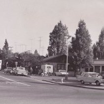
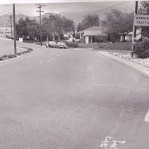
P6316A - Oakland Blvd. from Mt. Diablo Blvd., 1968. Douglas service station is at right, State Farm Insurance office at left. (as of 2021 the gas station is a Speedway Express)
Mt. Diablo Blvd. Oakland Blvd. Douglas Speedway Express automobiles 1968
Record Type: Photo
-
P6316B - Oakland Blvd. from Mt. Diablo Blvd, 1968. Police officer with motorcycle at right. State Farm Insurance office at left.
Mt. Diablo Blvd. Oakland Blvd. Police State Farm Insurance motorcycle automobiles 1968
Record Type: Photo
-
P6316C - Oakland Blvd. from Mt. Diablo Blvd., Walnut Creek.
Mt. Diablo Blvd. Oakland Blvd. Police motorcycle automobiles 1968
Record Type: Photo
-
P6316D - Oakland Blvd. from Mt. Diablo Blvd., 1968
Mt. Diablo Blvd. Oakland Blvd. automobiles 1968
Record Type: Photo
-
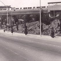
P6318D - Ygnacio Valley Rd. showing BART supports looking toward Oakland Blvd., c. 1968. Area on right became BART station.
BART Oakland Blvd. Ygnacio Valley Rd. automobiles 1968
Record Type: Photo
-
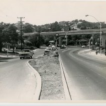
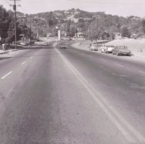
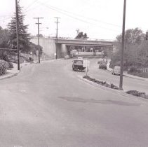
P6318E - Ygnacio Valley Road looking west. Oakland Blvd. on left. Hwy 680 overpass. C. 1968.
Oakland Blvd. Ygnacio Valley Rd Hwy 680 automobiles homes 1968
Record Type: Photo
-
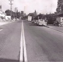
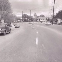
P6318F - Ygnacio Valley Rd. looking east from Oakland Blvd., c. 1968. Police car can be seen at center, Shell gas station further down the road on right side, Standard gas station on left side
Oakland Blvd. Ygnacio Valley Rd. Shell Standard Police automobiles 1968
Record Type: Photo
-
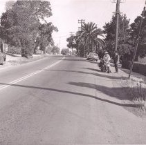
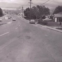
P6318H - Ygnacio Valley Road at Oakland Blvd., c. 1968.
Ygnacio Valley Rd. Oakland Blvd. homes autmobiles 1968
Record Type: Photo
-
P6318K - Looking east toward California Blvd. and Shell station. Oakland Blvd. merging onto Ygnacio Valley Road. Police car at center. C. 1968.
Ygnacio Valley Rd. California Blvd. Oakland Blvd. Shell Police automobiles 1968
Record Type: Photo
-
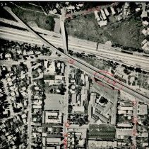
P6358B - With number at lower left corner, I 680 freeway on left, Bart tracks to right of I 680, Oakland Blvd running next to BART tracks. Lacassie Ave upper hand corner, Presbyterian Church just below Lacassie.
BART Oakland Blvd. Lacassie Ave. Presbyterian Church aerial 1974
Record Type: Photo
-
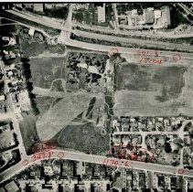
P6358Q - Trinity Ave - Shuey area in Walnut Creek dated 4-3-74. Trinity Ave. Oakland Blvd. Oakdale Rd. Almond Ave. Shuey Presbyterian Church
Trinity Ave. Oakland Blvd. Oakdale Rd. Almond Ave. Shuey Presbyterian Church aerial 1974
Record Type: Photo
-
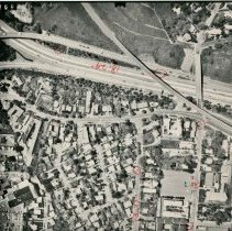
P6358U - Aerial view north of downtown Walnut Creek - Trinity Ave on right side of photo, shows I 680 north of Walnut Creek interchange - dated4-3-74. Hwy. 680 Oakland Blvd. Terraace Rd. Trinity Ave. Shuey Area
Hwy. 680 Oakland Blvd. Terraace Rd. Trinity Ave. Shuey Area aerial 1974
Record Type: Photo
-
P6358Y - Western Walnut Creek - Mt. Diablo Blvd going under I 680, Oakland Blvd just below freeway, Shuey area right lower portion of photograph - dated 4-3-74 Mt. Diablo Blvd. Hwy. 24 Oakland Blvd. Shuey Area
Mt. Diablo Blvd. Hwy. 24 Oakland Blvd. Shuey Area aerial 1974
Record Type: Photo

-
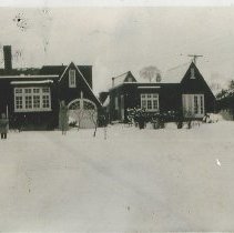
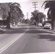
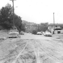
P6381 - Somewhere on Oakland Blvd. prior to freeway construction
Oakland Blvd. automobiles 1950's
Record Type: Photo
-
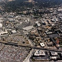
P6977.5 - LOOKING EAST OVER YGNACIO VALLEY RD AND BAART PARKING LOT. lOT WAS TURNED IINTO APARTMENTS ABOUT 2015. Seen in photo per back of photo: Mt. Diablo Blvd. Walnut Creek Presbyterian Church BART Oakland Blvd. Ygnacio Valley Rd. Lacassie Ave. California Blvd. Main St. Walnut Creek Motel Target Walnut Creek Library
Mt. Diablo Blvd. Walnut Creek Presbyterian Church BART Oakland Blvd. Ygnacio Valley Rd. Lacassie Ave. California Blvd. Main St. Walnut Creek Motel Target Walnut Creek Library aerial 1990
Record Type: Photo